Page 1 of 2
Maps
Posted: Thu Jan 24, 2013 1:52 am
by thirdkingdom
Maps go here.
Re: Maps
Posted: Fri Jan 25, 2013 1:21 am
by thirdkingdom
Re: Maps
Posted: Fri Jan 25, 2013 1:22 am
by thirdkingdom
Map of area around Threshold. 1 hex=3 miles.
Re: Maps
Posted: Tue Jan 29, 2013 9:22 pm
by Makofan
Re: Maps
Posted: Thu Feb 21, 2013 11:59 pm
by Bouv
Here's an updated map in JPEG form.
Re: Maps
Posted: Wed Mar 20, 2013 10:31 pm
by thirdkingdom
Crappy map of the area surrounding the caves. Big circles are hills. Green circle is the small grove in the valley, which is by this point certainly to small to hide your embiggened entourage.
Re: Maps
Posted: Fri Mar 29, 2013 8:50 pm
by thirdkingdom
Map of Karameikos purchased at the Spring Festival in Threshold. Note that I have assumed two changes to the map. One, there is a northern road connecting Threshold to Armstead. Two, the gnomish settlement of Highforge has been moved to the norther side of the Black Peak Mountains.
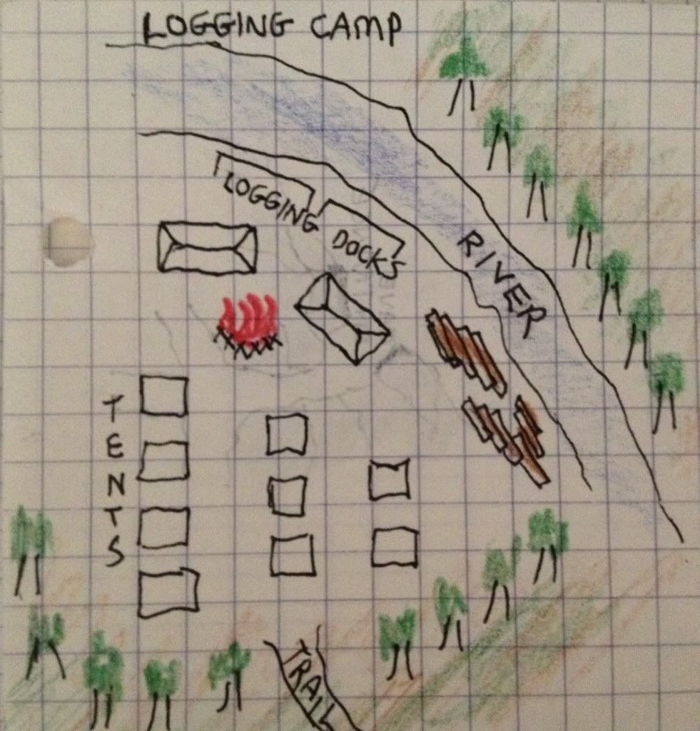
Re: Maps
Posted: Sat Mar 30, 2013 12:17 am
by thirdkingdom
Re: Maps
Posted: Sun Mar 31, 2013 10:55 pm
by thirdkingdom
Updated map. Quinthos's village is located at 31.00. The orc lair is somewhere around 43.03, 44.04 or 44.03.
The magic fountain is somewhere around 53.08.
54.16 Main Logging Camp
53.19 Myraal's Tower
53.08 Magic Fountain (guarded by "a man made of stone"!)
50.20 Threshold
49.21 Zoltar's
48.17 Castle Mistamere
46.18 Aleena's Cave
43.03/44.04/44.03 Orc Village (probably) somewhere around here
40.14 Eagle's Nest
39.05 Jessup
38.10 The Necromancer's Tower (partially cleared by party)
31.00 Quinthos's Village (elven village)
Re: Maps
Posted: Mon Apr 22, 2013 11:02 pm
by thirdkingdom
Re: Maps
Posted: Mon May 20, 2013 4:05 am
by frobozz
Elevation of Tower Mountain:
Re: Maps
Posted: Sat Jun 15, 2013 5:03 pm
by thirdkingdom
First Two Levels of the Necromancer's Tower
Re: Maps
Posted: Mon Aug 12, 2013 1:50 am
by thirdkingdom
Re: Maps
Posted: Tue Aug 20, 2013 5:57 am
by frobozz
Map of Castle Mistamere (First Level):
Re: Maps
Posted: Wed Dec 11, 2013 3:28 am
by frobozz
Map of Castle Mistamere (Second Level):
Re: Maps
Posted: Wed Dec 25, 2013 7:40 pm
by frobozz
.
Re: Maps
Posted: Mon Feb 03, 2014 6:50 pm
by Grognardsw
Re: Maps
Posted: Tue Mar 11, 2014 6:28 am
by frobozz
.
Re: Maps
Posted: Tue Apr 08, 2014 12:24 am
by Wyzard
https://docs.google.com/drawings/d/1Tyg ... sp=sharing
The above link will go to the Google Drawings map of the dungeon beyond the stone door in the forest.
Re: Maps
Posted: Sat May 10, 2014 1:18 pm
by thirdkingdom
Each hex is roughly 100 ft.